Tales from the Big Trails, in print on 2nd September 2021, available now for pre-order from Vertebrate Publishing. Featuring all 15 National Trails in England and Wales, and the 4 designated long-distance Scotland’s Great Trails. This is the story of the people I meet, the landscapes and coastal scenery and the sheer joy of walking these iconic long-distance routes in the UK. Click on a link below for a copy.
Tales from the Big Trails – Vertebrate Publishing
Tales from the Big Trails – Amazon
Overview
The granddaddy of them all, and for some, the ultimate National Trail challenge. This is a superb high-level route along the backbone of England, taking you through the Peak District, Yorkshire Dales and Northumberland National Parks. This is an exposed route and the weather will have a lot to say about how strenuous the walk will be. The landscape is rugged, wild and dramatic. You will be surprised at how remote you will feel at times and navigation will be a challenge if the clouds are too low. However, the hospitality and the friends you will surely meet will more than compensate.
Time of year
Winter is best avoided unless you have experience of extended journeys through harsh winter conditions. Spring and early Autumn are perfect. I finished in early October, and the landlady at Byrness suggested I would be one of the last through hikers that year before the snow threatened to arrive in The Cheviot Hills. The height of summer will be busier, and you will need to carry more water than you would expect. The sun will be unforgiving, with little shade and extended moorland crossings. Using Hostels accommodation I had little difficulty with availability in September/October, which I suspect would be an issue during holiday periods.
Length of walk
Officially the route is 286 miles, but that includes the Bowes loop and a diversion to The Cheviot. I completed the route in 14 days of walking, recording 260 miles, with two half days as rest and to synchronize the sections that allowed maximum use of Hostels. Some sections are long and strenuous. I chose to walk South to North, to have the sunlight the landscape ahead during the day and to built fitness for the last long day into Kirk Yetholm.

Accommodation
Initially, I had a full backpack ready, intending to camp as much as possible to keep costs down. At the last moment, I worked out a schedule that maximised the use of YHA and Independent Hostels which allowed me to travel light and take more clothing. Of the 16 nights away, 12 were spent in Hostels. This made a big difference to the cost overall and allowed me to meet many more walkers on the path as like-minded souls congregated at this establishments each evening. So I joined the YHA again, keeping 3-4 days scheduled through the central booking office. Wardens strangely couldn’t do this for you, as was the tradition. Meals were available at some hostels, or usually at a nearby pub.

Experiences
It was with some trepidation that I set out for Edale. Could I keep the schedule I had set? Would the weather conditions prove too challenging? Would I have the fitness and endurance? Perhaps I had heard too many tales of woe from other walkers, who seemed to exaggerate the reputation The Pennine Way man-eating bog and unnavigable moorland. I would soon find out for myself.
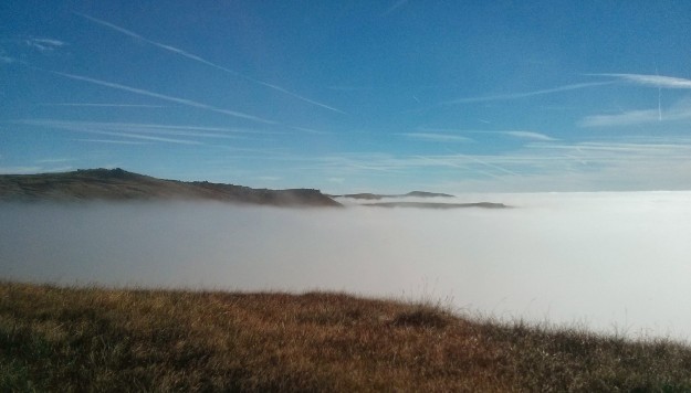
The train journey and connection to Edale from Sheffield was uneventful and was the short walk to the Edale YHA, a few miles from the official start of the path. The hostel was comfortable and I had a dorm away from some 50 Danish “Sprogskole” children, staying for a weeks adventure. I fortunately queued for breakfast early, otherwise it would have be a late departure. The initial section was heavy mist, but quite a few walkers about. Not a good start, but I started to relax into the walk as I reached Jacobs Ladder, ascending into what I thought would be a thick cloud. It was a joy to break through into bright sunshine and clear skies above the clouds, with an expansive landscape only interrupted by rock outcrops (Tors) and early international arrivals into Manchester Airport. The birdlife was very active, with Donald Duck sounding Grouse, Firecrests, Merlins and Wagtails enjoying the bright morning air, full of life. This was a glorious days walking, the stuff of dreams and peaceful. I only encountered a group of students sent on a mission to find the WW2 crash sites, giving them some guidance with my GPS Map. The descent into Crowden was rugged, with a warm welcome at the B&B (YHA was not available) and lift to a local pub, which served a soup roll, roast beef dinner and pint of J20/Water (my drink of choice for this trip) for £8.10! Wonderful.
“Cracking start Gromit”, I said to myself as I set out the next day in shorts and t-shirt, much to the amusement of the landlady. Eerily quiet in the hill fog, as I progressed to Black Hill, where Wainwright famously got stuck in the bog. The flagstones, that featured on the path the previous day, seriously improves the conditions underfoot and something to be thankful for. I crossed the A635, which no doubt is closed in heavy snow, towards a succession of reservoirs, that supply water to the large conurbations. I soon caught site of the lonely Great Western Hotel at Standedge through the mist, like a scene out of the American Werewolf in London. Fortunately I was staying a little further away at The Carriage House, which served a welcome Turkish Meal alternative to the usual chips with everything.
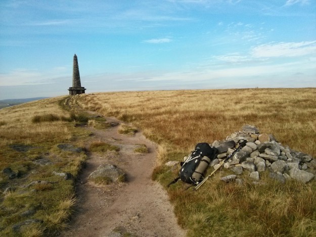
At breakfast I met Alan, a fellow walker, who had plans to walk to Hebden Bridge. We agreed to walk together for the day and exchange life stories and tales of our adventures. He had previously walked the PW before so I collected some useful advice. Passing Blackstone Edge, with stunning views across Manchester and then the M62 trans Pennine route, we stopped for lunch. Alan introduced me to Volterol, an Ibuprofen Gel – which seem to work wonders on an inflamed shin muscle, that was starting to protest. We arrived at Stoodley Pike early in the afternoon, where we went our separate ways, only to meet again, as planned at a local pub, where he was to meet another walker who was en route from John O’Groats to Lands End (aka JOGLE). After a good laugh, exchanging tall stories, I settle into the YHA at Mankinholes.
Day 4 was to be a long day, 25 miles and 11 hours of walking to Earby YHA. A black cat crossing my path suggested good luck, but it was immediately followed by a dead sheep, being feasted upon by crows. But balance was restored when a 3 legged Labrador, full of life and wagging its tail furiously, greeted me just before May’s Alladin’s Cave Farm Shop, which sold anything you could wish for. I stocked up and chatted to some cyclist who were also aiming for Earby. I’ll race you I said, jokingly. The next 20 miles had extensive views across grouse moorland. I inadvertently assisted the grouse beaters in flushing the poor things out, flying downwind to their deaths below. That stopped Donald Duck quacking. Whatever your views, I understand that the sport is economically beneficial to the area. I stopped at Top Withins for lunch, and pondered if this was the scene of Wuthering Heights fame. The PW signs were now in Japanese too, so this pretence is likewise good for business. More moorland crossings into Cowling and into Lothersdale, lovely villages and finally to Pinhaw Beacon. The views here are extensive. You are in a desert of moorland, seen in every direction and the sense of remoteness is intense, amplified by the late afternoon sun. A welcome descent into Earby YHA, which was once owned, by a founding member of the Labour Party, who gifted it to the Association. I met the cyclists, they were a few pints ahead of me.
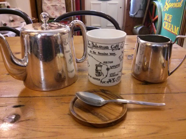
Nobody can snore like a Kiwi Rugby player! Perhaps one disadvantage of Hostel accommodation is that you don’t know who your fellow dorm mates will be. I didn’t care that I slept badly, as this was going to be a short day to Malham. The Dalesman Cafe at Gargrave served a great breakfast, tea and cake. They know how to take care of PW walkers. A short walk to across the “Aire Gap”, a rare break in the Pennines, saw me arrive at Malham YHA, where I rested until it opened at 5PM.
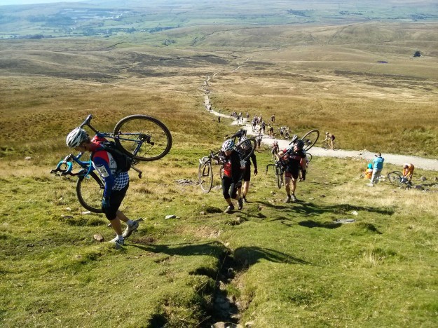
The Hostel is busy with cyclists, walkers and a French ultra runner, attempting to visit every county in Britain in 29 days, running 50 miles a day! He actually signed up with a company that organises such events for Elite Athletes and I chat to the owner about the record attempt. This is Day 2 for the runner and his feet are aching badly, so I lend him the Voltarol. They depart at 4AM to start running at 5AM the next day. Madness, he is actually paying someone for the pleasure. I breakfast with some walkers who know Scotland well before I leave early for Malham Cove. I have to the path to myself as I ascend to the spectacular limestone pavement above. Then on to the Tarn and up Fountains Fell, where I am accosted my 6 inquisitive Collie puppies, of which only one will be selected to become a working Sheepdog. They follow me for a while and the farmer has to round them up, which is a ironic. The fell top gives extensive views again to Pen-Y-Ghent, one of the famous 3 Peaks of Yorkshire. I ascend that peak and climb the drystone wall to be confronted by the annual cyclocross 3 Peak Challenge. 700 of them. More madness as I duck and dive on the descent to avoid a collision as I arrive into Horton-In-Teesdale. The balance between courtesy and competition is a difficult one.
I wake early to enjoy breakfast at the Pen-Y-Ghent cafe, which serves walker sized breakfasts. Pictures of the 3 Peak Challenge in the previous year shows torrential conditions and cyclist up to their saddles in water. I set off at a pace towards Hawes, meeting only a couple of mountain bikers and Enduro riders that day. RAF propeller trainers buzz me near the Ribblehead Viaduct in symphony with the bikers. Arriving into Hawes I am greeted by tourists dressed to the nines in expensive Arctic condition gear (but no idea!). My fellow dorm mate at the YHA however, is cycling 100’s of miles over the rough tracks in the area on a beat up Mountain bike and cheap adapted clothing. He is an expert of low budget adventures and shares a few tips. I meet an old friend for dinner, who encourages me to write a book. There’s a thought.
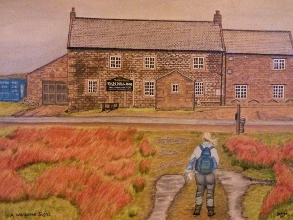
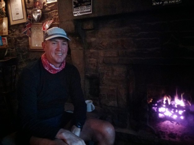
An early YHA breakfast, as good as any, and then I depart for Thwaite over Great Shunner Fell, which is in thick cloud. So no spectacular views of Swaledale today. I am comfortable now walking in a thick fog. Some views open up as I progress to Keld and then over more moorland to the famous Tan Hill Inn. A wonderful welcome and intense coal range warm my heart and legs. It is hard to resist a pint of Theakstone’s Old Peculiar. Fellow customers include the local Ghillie’s and occasional cheeky sheep, who apparently sneak in for the warmth too. I thought sheep weren’t clever. This place is full of character and often quoted on national news when heavy snow can result in a week long lock in. You can’t see the walls for newspaper articles and photographs. One particularly famous one showing the northern lights above the pub in winter.
The next days forecast is dreadful, so I put on all my waterproof gear and set out for Middleton-In-Teesdale. Bit of a shock having been in shorts for 8 days. Landlady advises against the Sleightholme Moor path, too boggy, but I suspect it is to keep walkers away from the Grouse Butts. Hard going to the A66 crossing and then over Bowes Moor, but my Meindl boots, jacket and waterproof trousers keep me dry. Its nice to know I can walk a full day in torrential conditions. I arrive into a cafe for Fish and Chips before sleeping soundly in a nice B&B.
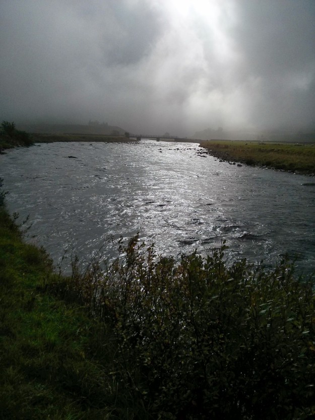
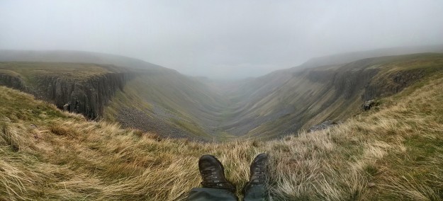
Wonderful breakfast, the best one so far, which powers me alongside the River Tees. I notice how pleasant it is to use the Durham County farm gates compared to the man trap Yorkshire ones. Low Force and High Force are flowing nicely, highest volume waterfalls in the UK apparently. I veer from the Tees towards Cauldron Snout, another impressive waterfall and then onto open moorland ascending into the clouds towards High Cup Nick, which I have little hope of seeing. But wow! The clouds clear and I’m fortunate to see this fantastic geological feature, which many argue is the best view in England and certainly of the PW. The symmetry is dazzling. I descend in more rain to Dufton YHA and an excellent meal in the pub opposite.
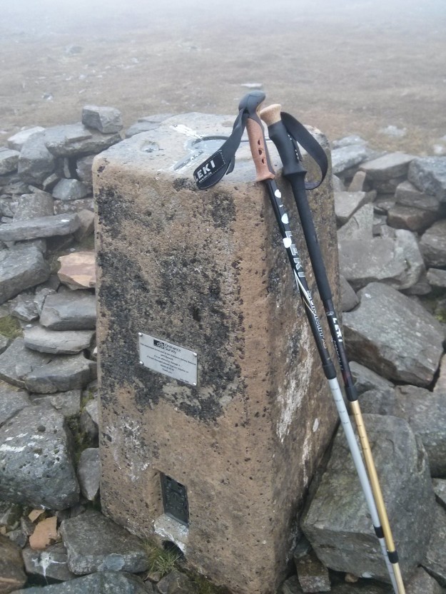
Day 11 – Cross Fell beacons. The highest point on the PW at 893m and a place with a fearsome reputation for high winds. I mistakenly follow Wainwrights Way, thinking it runs alongside the PW, but it doesn’t. A farmer puts me on the right track and gives me a local weather forecast which proves to be very accurate. I can see the Radar Tracking Station as I start the ascent, which is the last view I get of until I am 20 metres away from it. The cloud remains, but going is easy, if you can pick out the path. It is very easy to get lost up here and there are dangerous mine workings that must be avoided. Huge cairns and my GPS reassure me I am on the right track as I reach the Radar complex and then Cross Fell Summit. This place holds the record for the highest wind and coldest temperature in England I believe. It is also the site of the Helm Wind, the only named wind in Britain. I pause for a while before descending to a Mountain Hut for a welcome respite from the weather for lunch. A long path/track leads to me then to Carrigill and Alston. The local YHA has bumped me out, so I find a local Inn for the night, which had good food.
It is beginning to feel like I am coming towards the end. I can tell it is the weekend today as I meet quite a few walkers, all female I note. I reach a gate that proclaims “NOT The Pennine Way” – ok, so how about telling me which way to go? I try a gate but get eyeballed by an enormous Bull – which is a clear navigational hint, so I consult my GPS to get me back on track. Signposts are difficult to find on this section, but I reach Greenhead, for a nice cuppa and cake, before settling down in the YHA, which seems to be owned by the pub opposite and used to accommodate merry customers after a long session.
I wake early and find it impossible to even make tea, such is the rundown condition of the kitchen. But the early start leads to wonderful dawn views over Hadrian’s Wall, as I follow a section that coincides with the PW for 8 miles. Another black cat crossed my path, so I anticipate the dead sheep and 3 legged dog, but they don’t materialise. This section is like an Alton Towers Roller Coaster and just as exhilarating and I’m the only one riding. I veer away just before Housesteads through woodland and farmland, which have the full range of testosterone farm animals, Stallions, Rams and Bulls. They seem disinterested in me and more interested in the opposite sex as they are in the fields to breed. Conditions are boggy, as I approach the earthly named Shitlington Crag before reaching the market town of Bellingham. The YHA is unoccupied, so I settle in. The local Chinese Takeaway has 400 options for dinner and I am too tired to choose, so I copy the last order taken. The YHA warden appears later that evening, he had an anniversary party to attend, as does a Dutch Fisherman, who loves the place so much he comes over for a holiday for 2 weeks every year. Very cosy YHA, very clean.
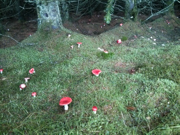
A short walk to Byrness mostly through forestry tracks and boggy paths between the largest Christmas Tree forests you have ever seen. Millions of Fly Agaric mushrooms litter the forest floor to create a dream-like pixieland scene. I keep my shorts on as it starts to rain, as I can’t be bothered to change. This section is monotonous, so I am pleased to arrive in Byrness. The Hostel is the only accommodation and is appropriately named Forest View Lodge. The landlady has a deep insight into PW walking culture and YHA politics. She says, school teachers arrive 2 weeks after term ends and she had 60 or so PW and LEJOG / JOGLE walkers this year. 100% more than last year, due to people losing their jobs in the recession and undertaking a lifelong ambition. Very pleasant natter and a chance to prepare for the last day.

Up before dawn, as the daylight will be a concern today. I have 27 miles to walk and 8 hours of daylight. I have been pre-warned about the boggy sections and missing flagstones as I set about reaching the first peak in the dark. I am greeted by a blood red sunrise as I set off over a series of peaks towards The Cheviot summit. This is border country and there is evidence of roman fortifications, not dissimilar to Hadrian’s Wall. The Cheviot Hills are also adjacent to a large Army training grounds and it is not long before I meet a series of competing squads, on a hefty route march. These guys are carrying 30-40 kg, plus weapons and ammunition, sometimes a huge GPMG and tripod. The seem to be powered by Snickers Bars. The squad leader has time to stop, and he asks me where I am walking as they have set a few trip wire booby traps to freak out the unwary. I return the favour by warning him of a lethal missing flagstone near Mossie Law. He is impressed that I am walking 40 clicks today (40km) and left Edale 14 days ago.
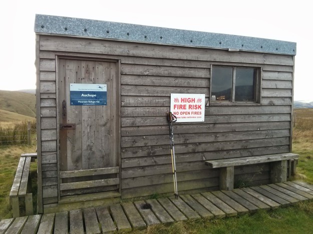
I feel chuffed that I seem to have a similar pace (but only a 7kg pack) as I arrive at Windy Gyle for a break. I meet more walkers (two guys in Kilts) on day trips, who instinctive ask me if I am walking the PW. The views now are incredible, the best I have seen in England, the visibility is clear enough to see the North Sea and deep into Scotland. It is like low flying. I continue on to Auchope Bothy, declining the optional ascent of The Cheviot, as it is in thick cloud. After my last rest stop I wearily pace it out into Kirk Yetholm, the pain is real, but also the growing sense of achievement. I arrive at the Independent Hostel, shower and stumble over to the Border Hotel for a pint (not J20) thanks to Wainwright and a nice meal. The landlady has seen it all before and anticipates the story I could tell, casually dismissing my 14 days as “not bad”.

That was a wonderful walk.
The next day I chatter for hours with the warden, to catch up on hostel news and stories of the PW and the embryonic Scotland National Trail, which starts in Kirk Yetholm and finishes at Cape Wrath. That’s one to do in the future, but I am following the Long Distance Walkers Association definition of a National Trail for now. I book a taxi into Berwick, which travel at a speed I can’t comprehend followed by an intercity train to London.

I wonder what’s on TV tonight.
Itinerary
- Day 0 – 2m – Travel to Edale – YHA – Start
- Day 1 – 16m – Crowden – B&B
- Day 2 – 11m – Standedge – Inn
- Day 3 – 16m – Mankinholes – YHA
- Day 4 – 25m – Earby – YHA
- Day 5 – 11m – Malham – YHA
- Day 6 – 15m – Horton-In-Ribblesdale – Hostel
- Day 7 – 14m – Hawes – YHA
- Day 8 – 17m – Tan Hill – Inn
- Day 9 – 16m – Middleton-In-Teesdale – B&B
- Day 10 – 20m – Dufton – YHA
- Day 11 – 20m – Alston – Inn
- Day 12 – 16m – Greenhead – YHA
- Day 13 – 21m – Bellingham – YHA
- Day 14 – 15m – Byrness – YHA
- Day 15 – 25m – Kirk Yetholm – Hostel
- Day 16 – 0m – Taxi to Berwick, train home
This totals 260 miles, in 14 days (two half days for Standedge and Malham to synchronise to the YHA locations). 17 elapse days.


Hello! It was nice to meet you today near Walkerwood Reservoir and hear about your national trail challenge. I wasn’t on a very long walk, but I always appreciate good company on any stretch of a walk. And its not often that one gets a chance to say thank you after the inevitable departure.
As for your pennine way experience, i thoroughly enjoyed reading it. I read a few of your other trail diaries too and they are fantastic. If it means much you have quite inspired me to try something similar (if I can convince my fiance to let me) Hope you arrived in Tintwistle in good time! Good luck with the rest of the Pennine Bridleway!
Matthew
LikeLike
Hi Matthew,
Finished yesterday on the last endless cycle section into Middleton. Great to meet you too, hope you make good use of any time you get to walk the beautiful British countryside.
Martyn
LikeLike
Thanks for writing this guide. I’ve walked a little of the Pennine way, and your descriptions bring back memories. Very useful for planning the next stages!
LikeLike
Your welcome. Good luck completing the trail.
LikeLike
Your story is and has been a great help. Due to work and family commitments I’m having to walk the trail in bits. My last end point was Malham Tarn (going north) so I still have lots to do.
My question is, once reaching kirk Yetholme where is the nearest train station as I cant seem to locate one which isn’t on the east coast. I need to get back to the midlands
LikeLike
I took a taxi to Berwick instead of a bus via Kelso. The most expensive part of the trip, but it saved a days accommodation. You can catch a cross country train from Newcastle.
LikeLike
I do trust all of the ideas you have introduced on your post. They are very convincing and will definitely work. Nonetheless, the posts are very short for beginners. Could you please extend them a little from next time? Thank you for the post.
LikeLike
Hi Martyn, Thanks for this , really enjoyed reading it .
Loved the American werewolf in London comment, we always say this about pubs on the moors “ don’t stray from the path”.
And always get laughs from people of a certain age , but always have to explain to American tourists, they need to watch the film.
Enjoy life
Sharon
LikeLike
No problem, it is what happens if you have too many pints of Old Peculiar.
LikeLike