
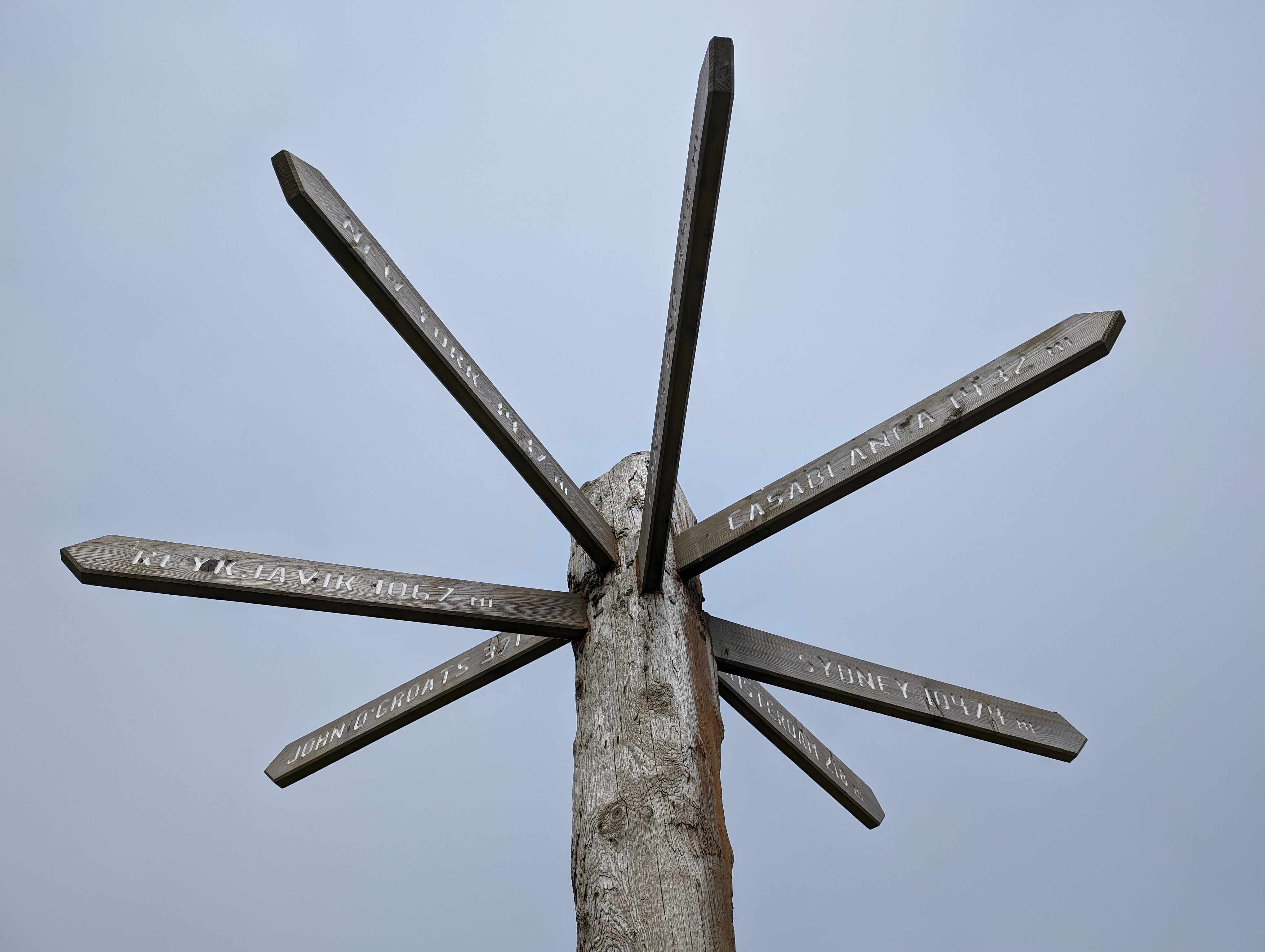
The King Charles III England Coast Path (KC3ECP) has yet to fully open between Bridlington and Sutton Bridge. Coastal erosion, shooting rights and key bridges will be significant challenges. I was not looking forward to hours of road walking, climbing gates and long remote sections without facilities, accommodation or escape routes. In the end, it delivered some of the most enthralling adventure of the trip so far: 300-miles of remote sea walls and beaches, interspersed by England’s hedonistic seaside resorts.

I timed the initial half-day after the train north to coincide with a low tide. The beach walk from Bridlington to Hornsea being a simple delight, yet in other circumstances would be impassible. The cliffs are 5-15 metres and unscalable. You must be very careful with tide, weather, wind direction and escape routes. The following day I walked 4 hours before high tide in beningn conditions and was 30-minutes from being cut off by the tide! The cliffs here are made of clay and disolve into the sea at a rate of 5-10 metres per year. In Roman times the coast was 1-2 miles further east. I would not walk along the beach south from Mappleton under any condition and took endless inland roads with occasional coastal fields not yet open, using the OS maps to guide me. to getb through. The crops sown in spring were already falling into the sea, as were the bandit country style holiday homes, leaving their former utility pipes exposed. This is throroughly unpleasant walking into Withernsea and beyond to Easington. I have no idea how Natural England will tackle this section of the path, or find funds to maintain it over time.
I developed blisters and rested. The next section, in contrast, around Spurn Head, was sublime. The very tip a very special white sand beach, remote, tranquil and beguiling. This area is one of the finest bird watching areas in Britain: Little Terns breed, Short-eared owls, and many a rarity taking a rest at the first sight of landfall. Camping again, the path into the city of Hull along the northern shore of the Humber estuary was very remote. I would not see a single walker of any persuasion until reaching Paull. The flotsam and jetsam consisted of TV sets, whale carcass and disturbingly high quantities of fishing equipment. This section is undergoing major coastal defence works, so expect frequent iritating diversions inland and make sure you have plenty of water and an ability to spend a night unless you have arranged for someone to pick you up and the rare access points, notably Stone Creek. It was 27 miles, with only roe deer for company and a few sketchy diversions on my part, which I would not recommend.
A bus brough me back from a cheap hotel in the city to walk through the docks and seafront to the Humber Bridge to meet my sister to walk along the longest suspension bridge in the world to permit such a crossing. The city had a wealth of culture, not only a remnant of their city of culture status in 2017, but a deeper connection to the north sea. In all my walks on the National Trails, I have noted how friendly the people of Hull can be, often offering accomodation and easy conversation. It was an easy day to New Holland, and a further remote day of endless grass sea wall between the coastal ports. Thousands upon thousands of new cars at Immingham, and yet more major coastal defence work into Grimsby, before walking the back streets to Cleethorpes.

Now the path (if there is one), enters the former military ranges at Donna Nook along sea walls with no official paths, but obvious in being freshly cut. An important bridge at Somercotes Haven has been removed by the Environment Agency, which should have been obvious given the thigh deep nettles. After reaching the car park, it was a relief to follow a path of sorts that marked the boundary to the military bombing range – just keep to the right side of the danger signs and navigate to the seawalls when you see one.
There is a good chippy in Saltfleet, embedded withing a caravan park, giving me the fuel I needed to carry on to Mablethorpe along lonely paths and open beaches at low tide. It was a delight to come across the Time and Tide Bell (timeandtidebell.org), with yound puppy barking away at its strange form. The expression on his face when I rang the bell will stay with me for a long time. An inland campsite provided cheap accommodation (as often happens the charge is waived when they hear of your journey) and a good nights rest before the start of a section of KC3ECP that is officially open to Skegness, which was an easy win, considering it is mostly a cycle track.

Ingoldmells was like a Saturday night in an industrial city after England won a world cup, yet at 11AM on a Tuesday morning! People were there to party and at times it was difficult to walk through the crowds. Skegness followed at a similar intensity, until the shock of returning to wild nature within matres of leaving the last car park and walking between the dunes and the tide to Gilbraltar Point. The sea is changing the coastline here, with new sea channels and shattered groynes. The visitor centre was the only stopping point before the challenge of getting to Wainfleet.

The options was to walk on private land and scale fence protecting a old metal bridge near the sluice gate, or backtrack to road walk (or catch a train) to Wainfleet village. A bit of research indicated that it was possible to do the former, but it is not recommended unless you are brave enough to climb the bridges defences. It was a relief for me to be able to do it and enter the very remote lands of Wainfleet Sand, where there is no water of facilities until you reach Boston (with a few unreliable exceptions). Be prepared.

I walked several miles inland to Wainfleet St Mary and a lovely campsite and returned the next morning to walk almost 25-miles to Boston, carrying 3 litres of water and prepared to wildcamp as a contingency. The route is very remote, I didn’t see anyone until I reached the open prison at North Sea Camp and had to wait for a prison guard to escort me along the public path the runs through the middle of the camp (more to check that I didn’t leave any parcels I expect). Then it is a simple walk along The Haven into the city of Boston, and to imagine the departure of the Pilgrim Fathers in the 17th Century to their new lands.

Very few people walk these paths and this continued as I left Boston along the inevitable grass sea wall, sometimes freshly mown, sometimes kept short by cattle; always lonely and remote. The RSPB lakes and marshes were full of breeding birds, defending their chicks with a low fly-by. The harrasing avocets and gulls a pleasant conversation for a dozen miles to Fosdyke Bridge. I found water at the marina and walked on the opposite bank into the wilderness of The Wash. I wildcamped on the sea wall, enjoying my evening meal while the barn owls hunted along the banks.
Rising early, I soon reached the bombing ranges and could sit for a snack as the BAE Systems Hawk T2 trainers descended from the sky to hit their targets. Several youtube enthusiasts filmed these non-kinetic efforts and delighted in recalling runs from more formindable aircraft with actual bombs during the previous week. It was an easy run into Sutton Bridge, arriving far too early for my B&B. I should have wildcamped again.
The next sections to Kings Lynn are extraordinary for their tranquility, lonelyness, solitude and isolation. There is nothing but a sea wall between the huge inland fields and the vast expanse of the marshes. Walking alone, with no other human in sight, or prospect of seeing anyone, I had a sudden urge to strip and walk completly naked, except for my Cascadia shoes, socks, backpack and hat – it was a sensual and thrilling experience, not unlike skinny dipping. Call it skinny rambling, and I suggest you try it too, for the sense of freedom was profoundly liberating. I walked 10-miles before changing into shorts and a t-shirt, just as I reached the Great Ouse, feeling like Schrödinger’s cat, neither clothed or naked; until observed.

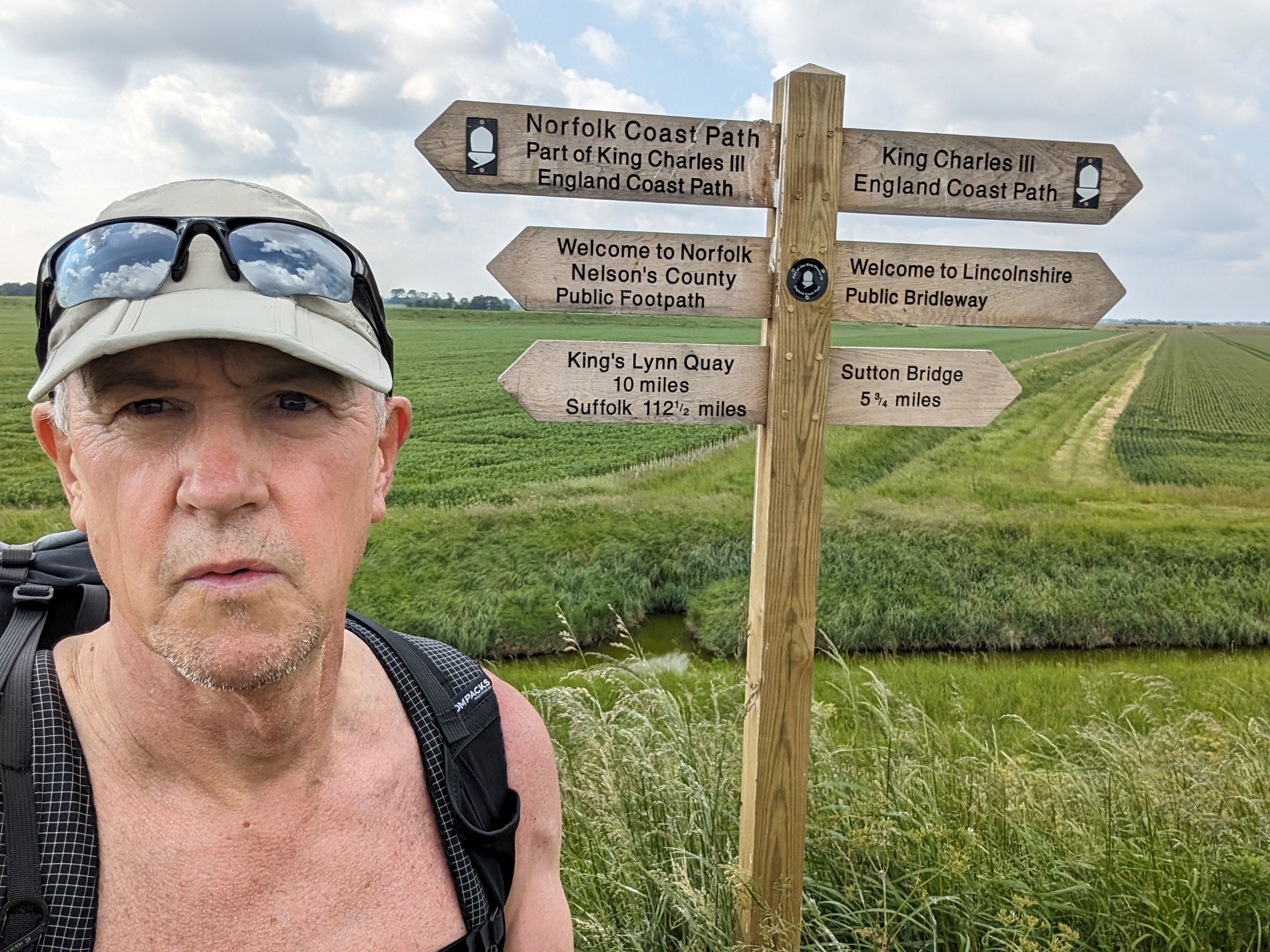
The ancient West Lynn ferry dropped me into King’s Lynn town, refreshments, people and cars! It was then an irritating road walk into uncut summer paths to the sea walls again on a section of KC3ECP opened only weeks before. This is wildfowl shooting and cattle country. The paths are rough and do not always follow the sea wall, but the lower path near the deep drainage ditch. This means you lose the view and have to navigate cattle drinking points which, if occupied, would mean a serious issue for progress. A fence prevents access to the bank, and a drainage channel means no inland options. This has to be addressed as an issue to the people who manage the coast path.
I reached the RSPB reserve, famous for it spectacular wildfowl displays of knot and oystercatchers during exceptional high tides. The contrast between wildfowl shooting and conservation seem irreconcilable. My wife had brought the campervan and would be my support for the last days into Cromer. What luxury after a 28 mile day.
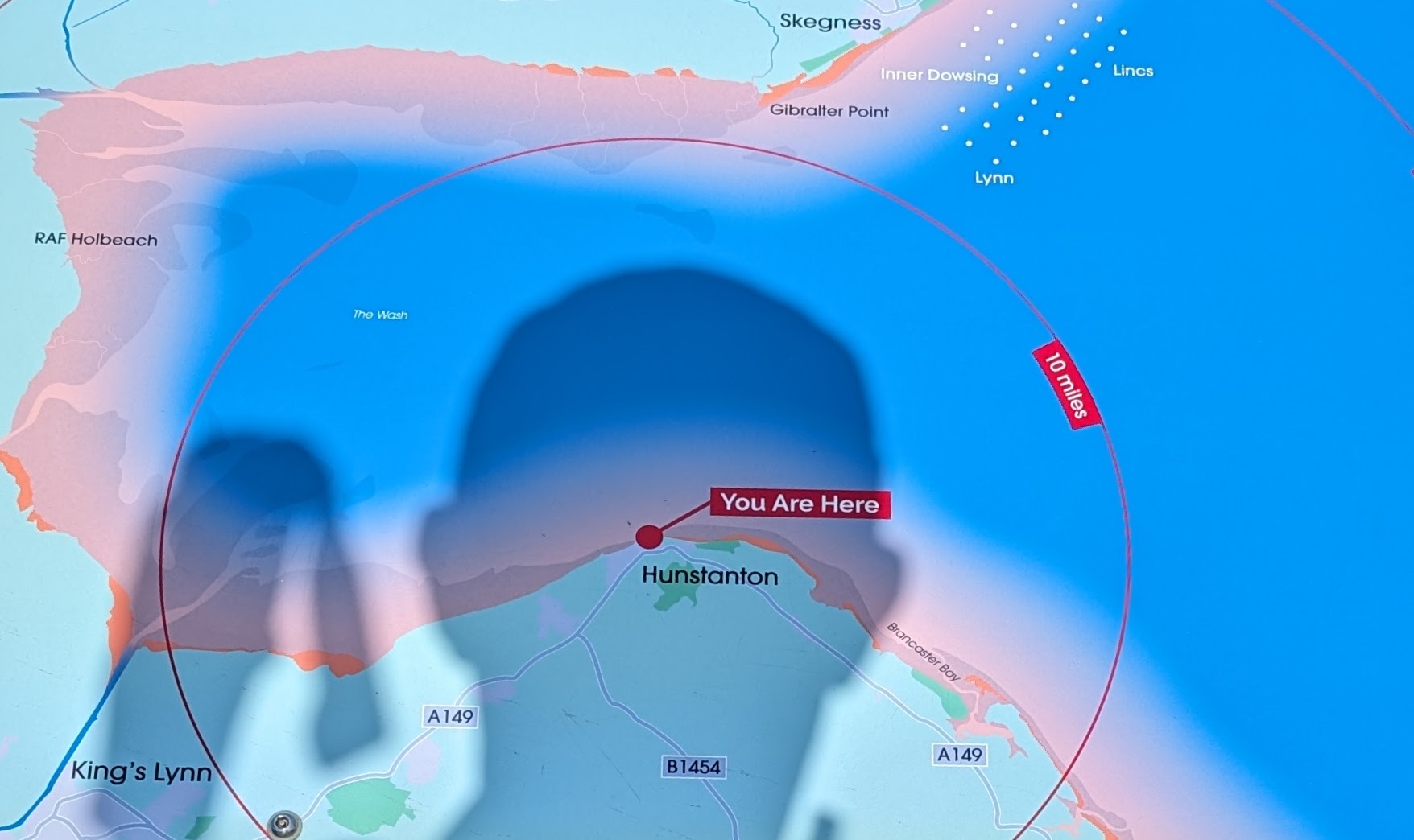
I was up early for the final miles along the Norfolk Coast Path – famialiar territory for me, having walked these sections many times before. Yet in the intervening years, new hardcore paths and boardwalks have been installed making it an easy walk. The multi-layer cliffs at Hunstanton are a surprise, the first since Yorkshire. Then the delight of long sand beaches at Holkham into Wells-next-the-Sea, for my final night on the KC3ECP.
Without my usual full pack the 30-mile day seemed easy, and with only 20+ miles to go, I would arrive on a Saturday into Cromer. The rain accompanied me along the dreaded shingle beaches, but the sun came out as I walked to the pier. There was a band, and a festival in full swing – blanking out my thoughts of achievement. My wife and friends greeted me and photographs taken. In total, 2400 miles, 116 days elapse days (105 taking into account half-days), so 23 miles per day of sheer joy.
The saying “The distance is nothing, only the first step is difficult” came to mind. As I listed the things in my life I am grateful for: health, freedoms, family, this coastline. I couldn’t help add “the last steps are the hardest” – for in those final moments I realised I would not walk this length of path again. Or, will I?


thanks Martyn, enjoyed reading and congratulations on yet another major achievement. Best wishes/David U
LikeLike
Thank you. It is slowly sinking in.
LikeLike