
I have had enough of road walking, but soon I’ll experience the glorious beaches and cliff paths of Sutherland and Caithness. I know this area well enough, but I will uncover new landscapes and paths that you will never see as a traveller on the now infamous NC500. I suspect many will be in a rush to reach Inverness on the A9, and will miss the secret coves, beaches and coastal villages that should perhaps remain secret, unspoiled, and wonderful.

The nights are getting longer, so a lie in until just before dawn works well, to the call of the early birds who gently wake you from your slumber. I am sleeping well in the tent, having found a near perfect combination of mat, airbed and pillow combination for my 6ft plus frame. The campsite still sleeps as I leave for Dornoch beach and head north to Embo – a community that declared itself a free state in 1988, with a formal letter of permission from Margaret Thatcher. I was lucky to experience that day with friends, as we exchanged their local ‘Cuddie’ currency for cask strength shots of Brora whisky.

I follow the old rail line around Loch Fleet, stopping to observe the seals and flocks of migrating birds, before walking through woods and fields to Golspie. The trail planners have thoughtfully offered an alterntive route, and I am perplexed as to why this should be, until I climb over the gate to be greeted by an enormous bull. I am sure he winks at me, to say I can pass, as he grants passage to a coastal walker.
My light breakfast is augmented by a fish supper from the chippy, eaten on a bench, before I set off around Dunrobin Castle on good paths to Brora, making use of the low tide beaches to sneak around unfenced cattle, the first to trouble me on my walk from Berwick. It is a good call, as the Co-Op is closed for refurbishment for food for the wild camp ahead. The local golf club is happy to top up my water bottle and fill the Platypus bladder so I can cook a freeze dried meal. The beach side pitch is perfect, snuggled into the dunes, waking early to witness the sun rising slowly from the North Sea, calling the geese to move from their roosts.

The rail line keeps me hemmed to the shoreline, difficult to navigate at times, until I cross the new bridge at Glen Loth and wander through the bandit country campsite to a rail crossing that leads into the hills above Helmsdale. There is no wind, the sun is out, and the cries of the seals resting on the rocks goes straight through you, for their is no other sound than my footsteps on the pebbles, rocks and occasional stinky seaweed. It is a stunning day.

The Thyme and Place cafe is perfect, serving a full meal that satiates a hungry walker. The chef suggests I inhaled the meal in one breath, and he is happy to see someone enjoy his cooking. It is a fuel reset I need, and I now have no concerns to reach Berridale. That energy is needed as the path climbs into the cliffside, which a rugged, tussocky, and requires careful foot placement.
I am now 100-200m above the sea, which is still calm, but my concentration is on the path ahead and navigation through bog, and heather to the clearance village of Badbea, where a few NC500 campers have ventured to see from the A9 car park above. The descent into Ousdale is challenging and steep, slowing my progress significantly, but I find a rhythm of sorts and now value the boots I am wearing, together with my Leki poles, which are starting to fall apart after some 2 or 3,000 miles of use around the coast of England. I tiptoe around resting cattle on the descent to Berridale, and cross the bridge. In a few moments I meet the prime movers of the John o’Groats Trail, who have done a wonderful job of promoting a fantastic coastal route on the east coast of Scotland – an EC630, Scotland’s alternative to the South West Coast Path. See their website John o’Groats Trail for the latest news and excellent guidance information.

The Halfway House Hostel is a perfect place to stay, comfortable, warm and welcoming. It is a good place to have a rest, for the sections ahead are challenging, even in good weather. It is not the climbing or overgrown paths, but a difficulty in finding good foot placement, where it becomes difficult to find rhythm and your propreoception (the bodies ability to know its physical form in space) skills will be shot to pieces. This requires concentration, which exhausts your mind as much as your legs. It is a relief to arrive at Dunbeath and easier paths that surround the private castle. The Spar shop is the only place for lunch, where a kindly owner makes me a cup of tea to go with a BLT sandwich.
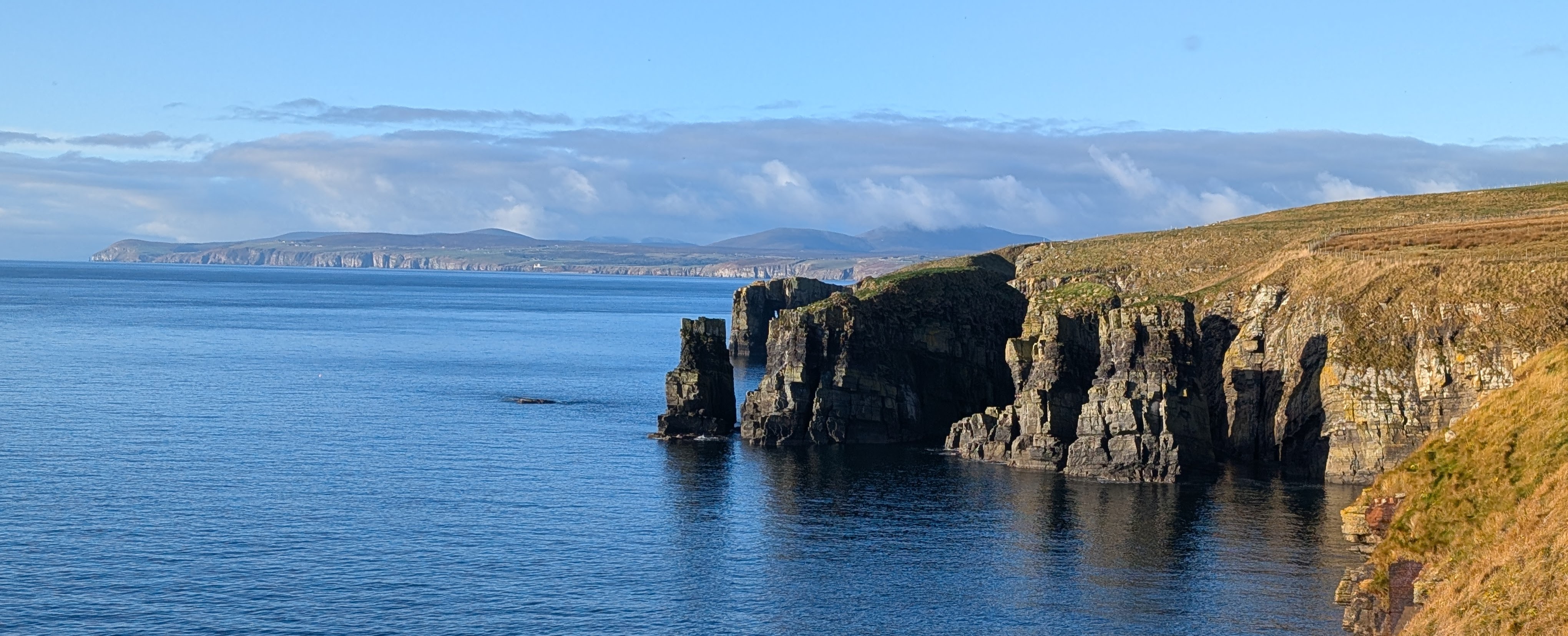
Latheronwheel comes into view soon, another quaint fishing village, now devoid of vessels and trade, with its ancient stone bridge still intact, now leading to nowehere in particular. The geology here hints of the scars in the coastline ahead – geo’s, or sharp cuts in the cliff following faults in the rock, that can go deep inland, and form rock towers and islands. These become more evident after Lybster, where I find an excellent B&B, and blow my budget on an evening meal and comfortable bed. Accommodation is almost double the cost of Aberdeenshire and Moray, now I have entered the world of the NC500, which now has package tours for those not willing or able to drive.

The tent will have to come out again, but the next logical point is Wick, where I can find cheaper AirBnB style keybox rooms for the night, and explore the town for food. It will take a good hard day to walk there, but now my legs are conditioned to the terrain, and a few diversions have been put in place to avoid stubborn cattle fields. Rock stacks and islands are frequently encountered as are the geos, as the cliffs decrease in height to give level (ish) walking.

I am drinking more than expected, so I welcome an open door at Whalligoe Steps to fill up. I’ll have to venture down these steps at a later date, so proceed past coves, more geos, caves and stacks towards the Castle of Old Wick, now fenced off to protect the public. It is a relief to walk on roads again (did I just say that), and wander past the superb heritage of Wick, with its wonderful museum.

I stock up, before heading east through the town to rejoin the coastal path past Papigoe and Staxigoe (geo placenames) to find boggy and moorland like terrain to the Noss Head lighthouse. It is easier walking now, past Castle Sinclair and Ackergill Tower to join the beach to Keiss. The sands are nice and hard, with one river ford to deal with and then cross the Subsea7 pipeline factory launchway and the grass tracks to Keiss, where I need to top up with water for a predicted wildcamp ahead. I would have considered a number of hostel options, but the buses do not run at weekends.

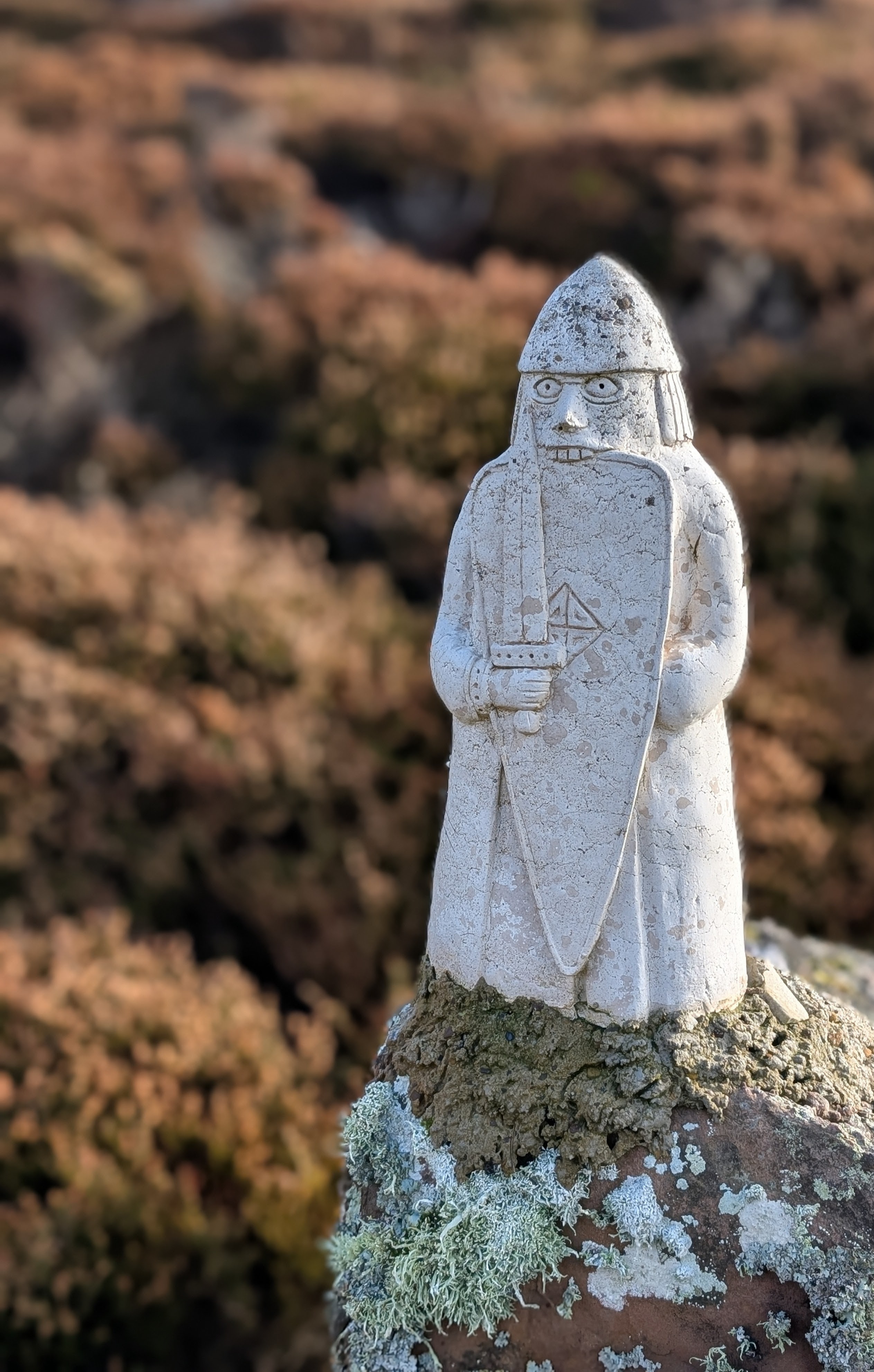
The amazing remains of brochs and castles continues the evidence of the startegic nature of this north eastern end of the British Isles. I dawdle along, timing a wild camp to the setting sun and find one pitch near Freswick Bay. This is my last night on the path, and my tent withstands a strengthening south easterly, and rewards me with a pink dawn as some compensation for deterioating weather.

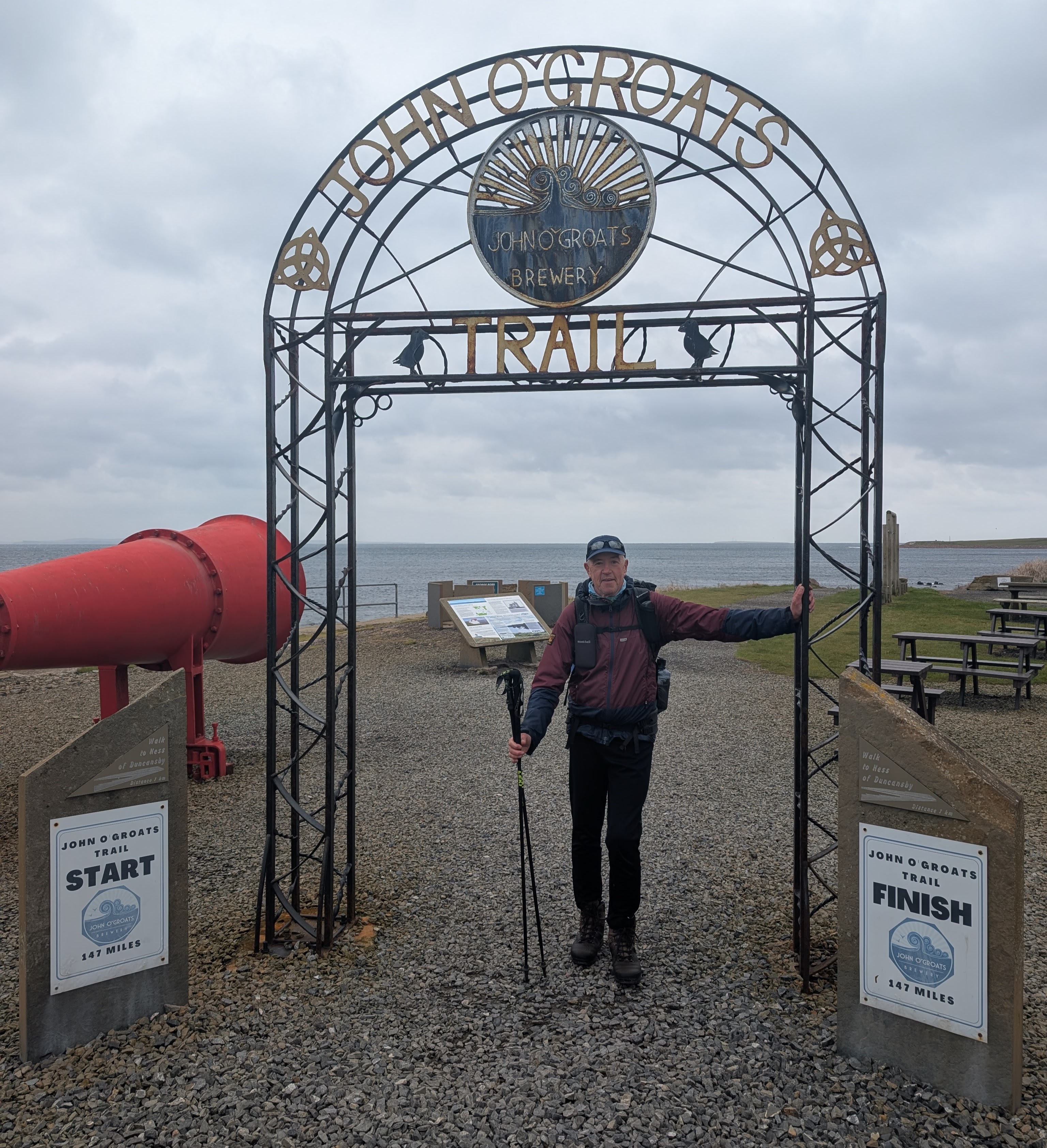
I have timed my arrival to meet a filmaker from the University of the Highlands and Islands (UHI), who would like to capture the experience of a coastal walker on the JOGT. The walk is boggy, but the tail wind assists me towards Duncansby Head and the frankly astonishing stacks, which stand like pyramids in the bay. It is a reward for walking the 147-miles from Inverness in 7 days, which is perhaps not recommended as a schedule unless you are happy with 20-mile days along rugged paths. I pause at the lighthouse, and engaged with a few campervan tourists, who are amazed that my journey started from Berwick, and I walked from Cullen on this stage.

It is a simple relaxing walk to John o’Groats and the JOGT gate, to be met for a quick meal and a pint at the hotel and a barrage of questions filmed with some expensive equipment. I get on well with the filmaker, who shares a great deal in common with me, and is an encyclopedia of local knowledge about this coastline. He gives me a lift to Thurso, for a cheap hostel to wake for a very long train journey home via the Calendonia Sleeper. I am tired, and it is wonderful to get back to my family and home cooking. I wasn’t expecting to complete this journey in 2025, and can now set my sights on future walks.
Overall, I recommend this walk for experienced walkers and would suggest a slower pace than I took. I was very lucky with the weather, and the train back from Thurso to Inverness would suggest that high tides, strong easterly winds would make some sections very challenging. Sure footedness is required and walking poles helped a great deal, as was a full backpacking kit to ensure I could either walk through windy wet conditions, or camp it out. Accommodations is available, and there are buses and trains, altough infrequent or no existant at weekends. The cost are a concern in peak holiday times, and judging by the volume of tourists in Inverness, the NC500 is very popular and pushing prices to ridiculous levels.
The JOGT organisation is starting to look at path development to Durness, the North Coast Trail. I am going to stop my journey here, for I have cycled that route by road, and explored the western coastline over four decades by bike, foot and campervan. One day, it would be wonderful to see a Scottish coastal path, to join the Welsh and the English trails. It would almost certainely be the crowning glory of a walk around Britain.

Thanks Martyn. I really enjoyed your piece here. I’ve never travelled this far north but am inspired to look into it further!
Hope all well with you and yours.. As ever I’m amazed at your stamina!
Best wishes David U
David
LikeLike
Thanks David, new book coming soon, so watch this space. I’ll keep doing this as long as I can
LikeLike